|
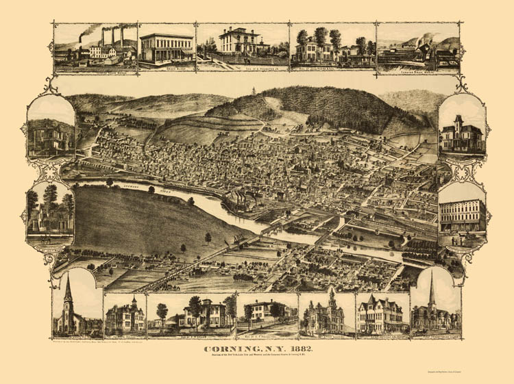
The view on the map is from what is now the north side of Corning (in 1882 the north side of the Chemung River was an unincorporated community called Knoxville - it was annexed into Corning in 1890) looking to the south at what was then the whole village of Corning. The Michael Gilmartin residence on East Market Street would have been in the neighborhood directly above the word "River" on the map. The 1867 picture, which viewed Market Street from west to east, would have been taken a bit to the east ( left on the map) of the factories with the smokestacks in the center of the map. The factories (Corning Glass Works) were not there in 1867 as the Glass Works moved to Corning from Brooklyn in 1868. Perhaps a bit of irony there - if the timing of the Glass Works move from Brooklyn had been a little earlier, Thomas Gilmartin might well have stayed in Corning rather than going to Brooklyn via the Pennsylvania coalfields. - Ron Yost |